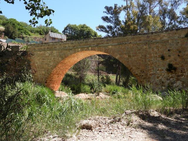
Patagonia – part 2

On Sunday, we did a full day tour to La Leona Petrified Forest. It is about an hour and a half outside of El Calafate. Our driver and guide, Leon, picked us up at the hotel and drove us north through the scrub desert.  We stopped at roadside hotel/bar/restaurant/gift shop, and picked up another couple for the tour. The landscape is very similar to the desert in Arizona but without cacti, just low scrub plants and grasses.

We reached the petrified forest, which is much less of a forest and much more of a huge rock formation with eroded sandstone and basalt. It is very stark, beautiful, and extremely windy. We hiked along the ridges of several the rock outcrops and slowly headed down in the lower portion of the valley. Along the way, Leon explained the rock formations, how the different layers were formed, and how they are eroding at different speeds based on the type of rock that they are. We found dinosaur bones where you could clearly still see the marrow and he explained that one way to test if a rock is a dinosaur bone is to lick your finger and if the rock (only small ones obviously) stuck to your finger, it was likely to be a dinosaur bone. We also saw many petrified trees, some of which looked like they were just bleached wood. It is always incredible to see how well the organic material has been preserved by the minerals, the tree’s rings and features are clearly visible. As we circled down into the valley, I did notice that our van was significantly higher than we were, which gave me some minor cause for concern. Anyway, we hiked around the valley finding lots of petrified trees, interesting geological features and a few dinosaur fossils.  

As many of you know, I am terrified of heights. It is quite frustrating for me. The logic and reason portion of my brain knows that I am not in any real danger, that I have great balance and never stumble or fall when walking, and just because I am near an edge, should not in any way make it more likely I will fall. However, the old reptilian, flee or flight section of my brain cannot grasp these details and just keeps shouting into my head NO! DON’T DO THAT! MOVE AWAY, DON’T GO THERE. Oddly, I have terrible balance, but no fear of heights or the edge of cliffs. Hmmmm, maybe I need more reptilian brain. I work hard to keep my mind quiet and sometimes it works, and sometimes it doesn’t. Our hike out of the canyon was one of the times that I could keep my mind mostly quiet. We zigzagged across one of the walls (which to be truthful was not a sheer drop, but it was a pretty steep drop) and up to the van, rising perhaps 300 meters. Neither Sue nor Robin were the least bit bothered by the climb, I on the other hand, needed a few minutes to collect myself after we reached the top.  

We packed ourselves back into the van and Leon drove us back to El Calafate in time for dinner. Robin craved meat for dinner so she headed off to a parrilla (steak house) while Sue and I headed back to Pura Vida for another home-style dinner. We ordered a bottle of wine called Fabula, which sounded like fabulous to me, but actually means fable. Despite the disappointing name, the wine was great.

Monday morning, we checked out of Hotel Posada los Alamos in El Calafate and headed for Torres del Paine in Chile. It was about a five-hour drive, once again across the scrub desert.  After about three and a half hours we turned off the road and down gravel road, and at this point, I thought to myself, sheesh, we are in a van with a driver we don’t know, we have no cell phone coverage, on a dirt road and have no idea where we are going. Sometimes I wonder about our decision making. However, it turns out that down the dirt road leads to the border crossing into Chile. We waited in a tiny shack for about 10 minutes for the Argentine immigration guard to do something with our passports and then finally hand them back to us and we were able to exit Argentina. We drove about a half a mile down the road, there was a sign that said “Bienvenido a la Republica de Chile” and the road was paved. We went another half a mile and reached immigration and customs for Chile. Once again, we entered a tiny shack where a young woman reviewed our passports and gave us some sort of paper. It appears that she has ample free time as there was a hair straightener plugged in next to her computer. We walked to the next little building which housed the police and customs. The police reviewed our passports and the piece of paper that the passport woman gave us and then stamped our passports. At customs, we put our luggage through a scanner, but the customs official didn’t seem to look at the scans. Once we finished crossing the border, our driver put our luggage back in the van and drove us about 50 feet to the next little building and put our luggage into a van run by our hotel which took us the rest of the way.

A few scenes from the drive

We are staying at the Hotel Las Torres, which is inside the national park, but still private land. They offer an all inclusive package that includes all food and excursions. The location in unbelievable and it is a perfect place for a respite from the outside world. We have no cellphone coverage and only have single digit speed internet in the hotel itself. Once we checked in, we talked to the excursions team and booked some hikes.

The hike starts on the right at the green/black circle and moves left to the blue lake. The distance/altitude chart moves left to right.

Sue and I decided that on our first full day, we would do one of the most famous hikes, called Mirador Torres del Paine, on our own. It is a 17km hike with about a 1,000 meter vertical climb. We woke up, grabbed some breakfast and hit the trail by 8:30 a.m. The hike is broken into three sections. Section 1 is from the hotel to the Chilean refuge (green circle with a white triangle on the right). It is 4 km up through the scrub desert and across the face of the mountain gaining about 400 meters, not particularly difficult, but there were sections with a 20%+ grade.

At about the 2.5 km mark, the course turned and there was a 300-400 meter stretch of very exposed, relatively sheer cliff. It is called Windy Pass, because typically the wind is blowing right through making it extra scary. We were lucky and had a calm day. Also, Steven is very brave. The path was easily two-people wide and while I was very uncomfortable, we made it through. The rest of the way to the 4 km mark was reasonably steep downhill to a refuge and we arrived there after a couple of hours. At the refuge, there is camping, bathrooms, a small store and picnic tables to sit and relax.

We rested for a little while then headed to section 2, the forest section. It is about 3.5 km, and as the name says, it is through a forest. It is a fairly easy walk, gaining only about 200 meters over the course of the entire section and it took us another hour or so. Section 3 is the tough part (starts at the green circle with a white triangle on the left). It is only 1.5 km long, but gains about 400 meters, with sections that are 40% grade and you are literally climbing over boulders. I hate boulders! The last 250 meters are once again across the face of the mountain, with a fairly steep falloff. This was one of those times that my inner voice could not be quieted. Yes, I know no one ever falls, that hundreds of people cross that rock field every day, that I should be more frightened crossing the road, but no matter what I was telling myself, I could go no further. I told Sue to carry on and I found a nice protected place and waited for her to return. I think she double timed it to the end of the trail, took a couple of pictures and double timed back to me. I am so grateful that she knows how to motivate me, when I need it, but also how to read the terror in my eyes and realize that I can go no further.

Once Sue had returned, we headed down. Now, my usual thinking is that down is always easy, but boy that last section was the hardest easy I have ever had. Climbing down rocks is nearly as hard as climbing up and I was especially glad we had our hiking poles.  Once we hit the start of the forest section, we stopped and ate our lunch as it was just about 3 pm.  The forest was relatively easy, although both of our quads had started to tell us that they were unhappy, we still had quite a long way to go and bunch of height to gain and lose. But mostly it was just a matter of putting one foot in front of the other to get to the Chilean refuge.

We arrived at the Chilean refuge at 4 p.m. and decided to rest for a few minutes. The remainder of the hike would be a climb of about 75 meters over a 300 meter stretch, along the exposed rock face, then about 3.5 km of relatively slow downward slope all the way to the hotel. We trudged up first 300 meters, reminding ourselves that we did this for fun. Once we reached the top, we turned the corner and were on the final downward stretch to the hotel. We arrived back at the hotel by 5:30 p.m. and collapsed into our room for a little while. We showered, headed to bar, had a drink, some dinner and were both asleep by 9 p.m.. It was a very long hard, but rewarding day. Even if I didn’t reach the end of the trail.

For our second day, Sue and I decided to do a half day excursion with a guide. Robin headed off on a full day excursion to another part of the park to see a glacier. Sue and I, along with about half a dozen other people, hopped into one of the hotel’s vans and headed for a hike that they describe as “Patagonia flat.” The walk is across the Patagonian steppes and features lots of guanaco, some cave paintings, and the possibility of seeing a puma. The drive to the trailhead took about 40 minutes and since it was drizzling, we all pulled on our rain gear. “Patagonia lat” means rolling hills, lots of 30-40 meter ups and downs and one big climb upward to reach the cave paintings. The “caves” are actually covered rock overhangs and compared to the cave paintings in France, they are quite limited. We rested there for a little while, then hiked back down off the rock outcrop and across the steppes. We saw lots of guanaco, learned lots about the plants and wildlife of the area, and happily, at least in my mind, did not see a puma. The whole hike took about 2 hours, it was a perfect amount of effort for us following the very strenuous prior day.

One more day here, then we are off to Punta Arenas.

On to Patagonia

Our last week in Buenos Aires was a bit of a whirlwind. My cousin Robin, an experienced traveler on her own, joined us on Monday. We spent the rest of the week working and visiting the last few places on our must see/eat list. On Thursday night we had a goodbye dinner with our friends Marco ndt Barbara at their place where they provided a wonderful feast, and we said a bit of a tearful goodbye.

Saturday morning we headed to the airport four hours early for our flight to El Calafate, having learned from our trip to Porto Alegre that the line to check in would be enormous. We were not disappointed, but what we did not count on was that Robin is a Delta Skymiles bigshot and her status with Delta allowed us to skip all the lines and check in quickly and easily. We zipped through the security screening and were in the boarding lounge in under 30 minutes. Since we had three hours to kill, we hunkered down and had coffee and breakfast. Good thing because the woman who was cleaning our apartment WhatsApped me a photo of the clothes Steven left hanging in the closet. Steven had time to taxi back, get his shirts, and still have time to finish his coffee at the airport. Usually we are good about checking every spot for left items, but somehow wit slipped our minds.) Our flight was on time (as it seems all Aerolineas flights are – even if they only allow 10 minutes to board) and relatively quiet. Not unexpectedly, we hit some turbulence over the mountains, but nothing to write home about – although, since my mother reads this, I guess I just have.

El Calafate is desert. Sue likened it to Arizona, but it is much colder and you can easily see the Andes mountains with snow on them. We checked into our hotels and then took the opportunity to meet at the Patagonia brewing company to watch the Argentina vs. Australia match. The USA lost while we flying, so I guess I was spared the disappointment of watching the games. Oh well, and good luck to Tyler Adams – the U.S. Men’s national team champion who went to the same high school as I did, and now plays for Leeds United in the English Premier league. Anyway, we watched as Argentina made easy work of Australia and all the Argentines (and us non-Argentines) enjoyed the game and the result. Afterwards, the main street was flooded with cars driving around honking their horns and there were several impromptu parades down the street.  

We had dinner at a place called Pura Vida. I would call the style Argentine home cooking. Sue had pumpkin soup and lentil stew. Which she said was the first true vegetarian food she has had in a restaurant since we arrived. It was muy rico! Robin had lamb stew and I had a chicken pie. All were very delicious and quite large.

Sunday morning we woke up, put on our cold weather gear (multiple layers, winter coats, hats and gloves and we headed to the Perito Moreno Glacier. Iguazu Falls which we visited a few weeks ago, demonstrated nature’s raw unbridled and immediate power. The Perito Moreno showed us nature’s glory in a whole different way. It stands about 30 kilometers (18 miles) long and about 80 meters (250 feet) tall at the face. The ice on the face is mostly white with an eerie blue that looks like back lighting. As you would expect from an ice formation, the temperature hovered in the low single digits centigrade. Our bus dropped us off that the visitor’s center on the south side of the glacier. The park has about four miles of walkways and steps (many many steps) that went from about 100 feet higher than the glacier (where the visitor center was) to the waterline. Sue, Robin and I walked all of them in our allotted 2.5 hours. Words simply cannot describe the amazing beauty of it, hopefully some of our (read Sue’s) amateur pictures will.

After a quick pack lunch we hit the bus again for a quick drive over to what the sign called “Safari Nautical.” It is a boat ride that takes people right up to the face of the glacier. We were quickly and efficiently loaded onto the boat and we headed up the lake to get a whole new perspective on the glacier. Once again it was glorious. The boat takes you close enough to almost reach out and grab the glacier.

Please try and remember that the face of the glacier is 80 meters tall.

We headed back onto the bus, and back to the hotel, quite exhausted, but with views like this out of the bus.

Our penultimate weekend in Nice

Friday was gorgeous, the sun was shining, and the temperature was in the low 20s.  We walked from our apartment to the Musee Matisse, which is nestled an area called Cimiez that is straight north of where we are staying. Like so much of the French Riviera, Nice is surrounded by hills, so once you leave the shoreline you are heading uphill. The walk was only about 3km with a 100 meter incline – easy compared to Istanbul, but still uphill. The museum is in his house and much of the collection was donated by his wife. You enter through a recent addition that is below ground level and work you way up. The lower floors display earlier works and explain Matisse’s education and influences. The top floor holds most of the collection. I was very surprised by the amount of work that he did in sculpture and other media as I think of him only as a painter.

Just outside his house there is a large park that leads to the monastery’s cemetery, where he is buried. Of course, we wandered through the graveyard until we found his tombstone (it was well marked, and we really just had to follow the signs). Dead person bingo part ??? I don’t remember. I have lost count.

We walked home (all downhill!) and then had dinner at a Portuguese restaurant (Le Barbecue) that one of Sue’s friends recommended. After dinner, we wandered through the old town and found nice bar (where the waiter refused to speak French to us and many others around us were speaking English, feh!), sat outside, had a drink and watched the world go by.

Saturday, Abi was flying home from Marseilles. Our plan was to rent a car, drive to Calanques National Park, hike for a while, drop Abi at the airport and then come home. Unfortunately, the weather gods were not cooperative. It rained all day, and we did not bring our wet weather hiking gear, so we had to abandon our hikes. Instead, we decided we would have a late lunch and then take Abi to the airport. For the first time that I can remember we found that Google had incorrect information about restaurant hours. We tried three different places, all of which were listed as open, but none of which were. We finally settled on grocery store take out. Not our most memorable Saturday, but it is always nice to spend time with my daughter. There were a few successes: we managed to drive a couple of miles into the park and find a nice photo spot, we had an interesting tour of Marseilles including a “road” called Impasse du Moroc – which was nearly one car wide, and our rental car was a sweet little Mercedes. (I think maybe Steven has been convinced to buy a Mercedes in Germany, drive it around and ship it home. Win for me!)

We only have one more weekend left before we return to the US for Thanksgiving. We are really looking forward to seeing our friends and family.

Into the Alps

We headed out Friday morning for a town called Chambéry. It is about 4 hours southeast of us and in the heart of the French Alps. For those of you who are fans of the Olympics, it is an hour north of Grenoble (1968) and an hour and a half west of Albertville (1992). Once we arrived, we did as we always do and wandered the town. For some reason there is a giant fountain of elephants in the main square. I will leave it to you to investigate why.

On Saturday morning, we went for a stroll in the market and then headed out for our day’s main activity, a “leisurely” 11.5km (7.2 mile) hike that we found on AllTrails called Circuit of the Bridges. It was in a small village called Saint-Jean-d’Arvey about 10km away. I neglected to notice that it was also 335m (1,000ft) higher than Chambéry.  For those of you who do not know me, I am very skittish when it comes to heights. Driving up and down mountain roads is at best difficult and at worst has me wanting to curl up in the back seat and whimper – even when driving. So the ride up to the trailhead was a little unnerving, but we made it.

The trail started at 600m (2,000ft) and was easy to find, but AllTrails states that the elevation gain is 450m (1,500 feet) which is well within our limits; afterall, we climbed Toubkal in Morocco, which was 16km and 2,500m (8,000ft) in elevation gain – just to the base camp. However, that was 4 years ago, and we had not been sedentary for 18 months due to the pandemic. I found the hike quite difficult. It started by dropping 250m to a single span wooden bridge over a deep ravine. (Oh yeah! Walking across a wooden bridge with a terrible fear of heights! ) I took a deep breath and pressed on. (He’s very brave.) I even stopped for Sue (who has no fear of anything and is a hiking machine) to take a photo of me – I am attempting to smile.

From that point it was an all-uphill hike to about 700 meters (2,300 ft). We had a picnic lunch along the trail and then climbed up and down the ravines.  We made a detour of about 1.5km when we followed an incorrect sign on the path. (Oops! It said Thoiry, but we didn’t notice it also said “the long way.”) The village of Thoiry is about halfway through the hike. We had hiked almost 8km (5 miles) and I was done. Sue graciously agreed to cut short the hike and we took a couple of short cuts and ended back at our car in Saint-Jean-d’Arvey after about 12km (7.5 miles), a bit longer than the original hike length. I still don’t understand how we cut the hike in half and took a shortcut, but still hiked longer than the original long route. Faulty GPS, faulty AllTrails, faulty us? Over the entire walk we saw perhaps 10 people, so it was just us, our cameras and our thoughts. Enough words…Here are photos

Sunday we decided to go to Grenoble to look around. We started by visiting the Resistance Museum. It was very well done (and free, but they did not have a “Viva la Resistance t-shirt — disappointing) and we spent about an hour in it. Afterwards we wandered into the old part of town and were terribly disappointed. Nothing was open (ach, dimanche!) and we just didn’t see anything of any interest. We walked back to the car and headed home.

Google says it is a 4-hour drive on the highway; we drove to Lyon on the highway, stopped for some lunch on the highway and made the grand decision that we were in no hurry to get home. Steven neglects to mention that we took the highway hoping that the rest stops were open since there was no other way to get food on Sunday. We told Google to find us a way home without the highways and off we went on a scenic tour of France. Boy do the French love roundabouts (des rond points). We hit one every kilometer or so. After a few hours we decided to head to a medieval city called Beaune that one of our friends said was pretty (also it is the wine capital of Burgundy). By the time we got there, it was about 7pm and we once again had a wander. (Restaurants were open. Viva la tourisme!) The place was packed with tourists and after about 45 minutes we had enough.

Once back in the car, we decided to go back on the highway and covered the last 130km in about 90 minutes. It was nearly 9pm by the time we got home. A long but very fun day.

Have spreadsheet, will travel

Ah…the joy of Excel

In the world before the pandemic, Sue had booked a trip to Italy with her niece as a high school graduation gift. Unfortunately, the COVID-19 virus caused her to cancel the trip and her niece is not available for a trip this summer. We have about $3,000 of flight credits that we need to use up this year, so we decided to go out on a limb and book a trip for the summer. As you all remember, before we go anywhere, I start a spreadsheet and while I am a little out of practice, here is my first stab at a preliminary itinerary for our trip to France.

On an accounting geek side note: Since we are using flight credits to pay for the tickets, I am currently meditating on how to list the price for the flights. One one hand, if we are looking at this sheet as a measure of the cost of the trip, then I should include the price of the flights. On the other hand, if we are looking at this as a list of the amount of cash we will be spending for the trip and since the flight credits are use it or lose it, then perhaps I should exclude the cost of the flights. Just a quick meditation on the accounting for the trip. Feel free to weigh in if you choose.

Preliminary trip plan

I think we previously mentioned that Sue has a friend who lives in Paris. Last year she and her wife moved out of the city to Burgundy. We decided (somewhat uninvited?) to go and visit them. In outline, we plan to fly into Geneva, visit Burgundy, drive down through Provence, along the Cote d’Azur and up into the French national parks to do some hiking in the Alps and then back to Geneva. Our thought is that if we are both vaccinated we can safely travel, but perhaps this isn’t the time to go romping around the cities and visiting crowded museums and windy little streets. So instead, we will plan to spend much of our time seeing Sue’s friend, driving around the countryside (perhaps visiting a winery or ten?), and hiking in the Alps.

Right now we are doing our usual planning process which consists of us reading anything we can about places that may look interesting and writing notes down (usually on little slips of paper or Post-It notes). At some point we will collate them and figure out which ones make the cut. We usually end up with about three times the number of things that we can possibly manage in the time that we have, so hand-to-hand combat between Sue and myself ends up being the deciding factor. Yes, Sue always wins, but that is because she fights like she is from Queens and I fight like a gentleman. I created a very preliminary list of National Parks that look interesting and a few other places I have heard about/see somewhere etc. Sue has begun to read about places and we will, at some point soon start to make a plan. If anyone has suggestions, please feel free to let us know.

Who knows, by the time we finish the plan, for all we know we will spend three weeks in Italy instead. 😉

Hiking and Wondering

img_20190622_164128085-1.jpg
Bear Creek Trail at Point Reyes

Saturday was beautiful and sunny. I loved it. No jacket necessary. Finally. We headed up to Point Reyes National Seashore after dropping the dog at day care. No dogs allowed on national park trails and Bijan has some separation anxiety. I mention this because we had to be back by 7 p.m. to pick him up. We were going to do a trail on a spit of land that pokes into the Pacific on one side and Drake’s Bay on the other, but we were lazy and got a late start and the trailhead is about 30 minutes into the park by car. Instead, we hiked from the Bear Valley Trail from the visitors center. The trail is mostly flat with very gradual incline, nice after Friday for my legs, which are Midwestern (read: flat, Flat, FLAAAAT) acclimated.

img_20190622_165756052
Zion shirt, Costa Rica bandana

I am 95 percent sure I have done this trail before, long ago when I lived in the Bay Area, but I don’t ever remember seeing so much water. It’s been raining around here for a couple of winters now, so everything is green and the walk was verdant and smelled of fresh vegetation. Aaah.

As we walked, I thought, as I have done in the past when I hike, that an interesting research project (if it hasn’t already been done) would be to study who says hello to whom on the trail. I’ve noticed that young men tend to ignore us old ladies. (Are they afraid we’ll yell at them because their chores aren’t done?) What about other group, gender, race, and age dynamics? There’s a ton of material there. Hiking is a different social situation and self-selecting and I am really curious about what the norms are. I just handed someone a great sociology project. Go for it and let me know.

First Full Day

img_20190621_114740124_hdr
A blue heron helped kick off our hike.

We were so busy yesterday, I didn’t have a chance to write, but I”m still feeling the effects of our hike. Did you flatlanders know that there are these huge mounds of land called hills and they are harder to walk up? Yes, it’s true. Yesterday we went to the Golden Gate National Recreation Area and did a 3.5 mile hike into the hills about the beach. It was beautiful and only took a couple of hours. So strange how crowded the Bay Area is, but the open spaces feel so free. Mahru’s dog, who you met yesterday, loved the hike, too. We think he found a rattlesnake just inches off trail in the brush. We heard it, but didn’t see it. That’s fine by me.

img_20190621_125815324_hdr
Just cool enough for a hike (which means a little too cool for me) but gorgeous views.

img_20190621_163637698_hdr-1.jpgAfter lunch, we stopped at the Columbia sportswear employee store and did some “I don’t need this” shopping by which I mean I walk around with things I like and then put them back because I don’t need them. We were really killing time until the East Brother brewery opened at 4. We each had a light, lemony pilsner called Bo Pils. Perfect for after a hike. The brewery is in a Richmond  industrial park and has some picnic benches outside, so we sat in the East Bay shade and relaxed. We got there right at 4, when it opens, but there were already a couple of people there. By the time we left, it was filling up. There’s no food, so a revolving list of food trucks parks outside. Yesterday was Thai. We didn’t eat any, but Mahru said she had and recommends it.

Then, we headed back to Oakland to get ready for an open mike and poetry slam. Once a month, MLK Cafe, an Ethiopian restaurant that also serves burgers and pizza, hosts the Root Slam. The community is welcoming and the artists obviously find great inspiration and support though the organization and events. Plus, they can write and perform! Just listening to other people’s stories and views makes it worth the trip. The food is pretty good, too, but shout out to my own neighbor, Eden, who makes the best Eritrean food ever. By the time we got home from that, I brushed my teeth and crashed.

P.S.: So far, the traffic is not nearly as bad as I imaged it would be. Maybe my bar was very low.

Oh The Things We Will Do & See

We (read Sue) did quite a bit of planning for Costa Rica this weekend.  Usually we try and organize quite a bit of our excursions before we go, or at least we sketch out what we are doing.  For this trip, we decided to plan what we wanted to do but then pretty much try and book on the day or the day before.

The first few days we are staying near the Manuel Antonio National Park. While there we will certainly go white water rafting on the  Upper Naranjo river.   We found a company call Pro Rafting Costa Rica and plan to book through them.  Some other things we are thinking about doing are:

Nighttime walking or boating tour in the National Park. The nice thing about the walking tour is we will be right in the ju03ngle, so close up to what ever we find. On the other hand…we will be close up to what ever we find!  The boat tour sounds more leisurely, but that isn’t usually our style.  Either way, it should be fun–in the jungle, at night.

Mangrove kayaking. There are lots of mangrove swamps and kayaking through them looks like it will give us a daytime view of the jungle at a safe distance from the land-based wildlife.  Sue tells me that the alligators don’t usually eat people as long as they stay in their kayaks. Hmmm: Could she be planning something?  One of the tour operators offers this at night, too.S o alone in a swamp, that is in a jungle, in a foreign country, where we don’t speak the language (Hey, I have been doing Duolingo for 64 days and can say useful things like: Do you work in a factory?) and separated from man- human- (?–yes, human, unless you think they are trained to eat only men) eating animals by a few millimeters of plastic. Sounds perfect.

Ocean kayaking/snorkeling. This tour takes us out into the ocean to kayak and then do some snorkeling.

Segway tour. Segway tour?  Really, going all the way to Costa Rica to ride a Segway?  Well, there is some history to this one.  Before started our blog, we traveled to Morocco (BTW: fabulous trip, fabulous place, a really great vacation for anyone with a small amount of adventurous spirit). For my birthday, Sue organized a Segway tour of Marrakech.  Unfortunately, the tour guide no-showed on us.  Needless to say, it is all Sue’s fault and she owes me a Segway tour.  Maybe we will do it in Costa Rica.

cano-island-costa-rica-scuba-300x216Scuba Diving.This is a long shot.  Sue didn’t really love diving when we did it in Hawaii, but perhaps she will give it another try.  (I said I would. I was just cold and seasick from the boat fumes.) One of the downsides to it is that there is a 10-mile boat ride to the island and she gets seasick (a very terrible feeling) so we will see.

Hiking.We will be going hiking, in the park, near the park, and anywhere else we can find.

Enough for today.  We will write about the things we will do near the Arenal Volcano for our next post.

It is Getting Kind of Late

We seem to be off to a slow start with our Costa Rica plans and I am not sure why. Sure, we have our flights and hotels. We have generally planned where we want to be and when, but no real firm plans. Perhaps this week we will get down to brass tacks and figure it out.

Day 1. We know it is all about getting there. It seems like we will be travelling all day. Our flight is from Chicago to San Jose, with a stop in Fort Lauderdale. I think we arrive early evening. We are renting a car and driving to a coffee plantation.

full-manuel-antonio-park-sign(1)Day 2. An early (9 a.m. I think –maybe a bit later) tour of the coffee plantation then a drive for a few hours (3? 4? more? who knows) to our hotel in the west coast town of Quepos that is right near the Manuel Antonio National Park (I always think that I am missing one of the names for the park….I feel like there should be a middle name in there–but perhaps that is just me).  No, I keep calling Manuel San Antonio. I expect we will just look around, settle in –maybe take a quick trip to the beach to see the Pacific Ocean (Yup…that’s the Pacific.  Yup…it is wet.  Yup…it has waves) and unwind a bit.

Days 3 & 4 & 5. We know we are going to go rafting one day. I have done some inquiries and found a 1/2 day trip on the Upper Naranjo river, I will probably book that this weekend. The other days will likely be hiking in the park (the one that is missing one name), visiting the beach, maybe a kayaking trip and seeing what other types of trouble we can get into. But we have no set plans –yet.


full-arenal-volcano-blowing-smoke
Notice at Trailhead (Translated from Spanish):   It is forbidden to throw your hiking partner in the volcano


Day 6. We are going to drive up to the Arenal Volanco. (By the way did you know that Costa Rica has 200 volcano formations, 100 that show some signs of activity and 5 that are classified as active?) Once again, I have no real idea how long the drive is, but I assume it can’t be more than 2-3 hours. That should leave us with 1/2 a day or so to visit places on the way or find something to do once we are there.

Days 7 & 8. We have not made any plans. There seems to be a bunch of places to hike with hanging bridges (you all know how much I love heights), I found a link to a route that goes to a waterfall (only 16,000 steps & up both ways!), and who knows what else. Apparently tossing your hiking partner into the volcano is frowned upon (perhaps less so if they are a virgin?) so I guess I am pretty safe from that. Anyway, you can assume that Sue will run me ragged climbing up and down things for both days.

Day 9. We fly home.

spreadsheetI know! I know!  We are way far behind in the planning process and I must admit–it is all my fault–I haven’t created the spreadsheet… and as we all know…nothing ever gets done in this world without a good spreadsheet. I am not a spreadsheet convert, yet, but I know Steven can’t live without them.


Why I Go Anywhere

As I sit here with my winter break waning, I turn my thoughts to hiking in Costa Rica. I can’t complain about the weather here (it was above 50 degrees today!) but it won’t last and I need to have an out in my head for when it temperature drops like a stone.

parque_nacional_manuel_antonio_1
Manual Antonio National Park: The peace of the unknown


I’m going to leave the musings on whitewater rafting to Steven. I don’t imagine we will be doing 10-mile hikes in Costa Rica since the trails near us are short. Manual Antonio National Park is a mere three square miles. I am totally cool with that since that means I can really take my time and drink in my environment. I haven’t spent any time in tropical climes, so I am looking forward to being immersed in a world foreign to me.

Being surrounded by newness feels spiritual for me. When I’m amid a crowd of people who aren’t speaking English,  my senses bombarded by unfamiliar smells, sounds, sights, and even the air touches my skin differently, I feel at once in the moment and completely out of myself. That feeling more than anything else is the reason I travel.