We headed out Friday morning for a town called Chambéry. It is about 4 hours southeast of us and in the heart of the French Alps. For those of you who are fans of the Olympics, it is an hour north of Grenoble (1968) and an hour and a half west of Albertville (1992). Once we arrived, we did as we always do and wandered the town. For some reason there is a giant fountain of elephants in the main square. I will leave it to you to investigate why.


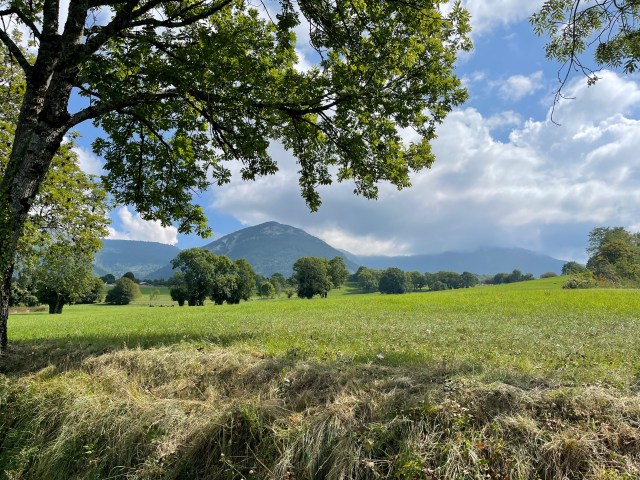
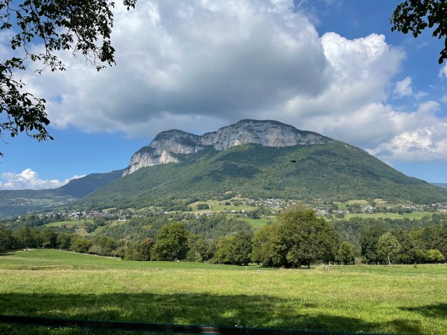
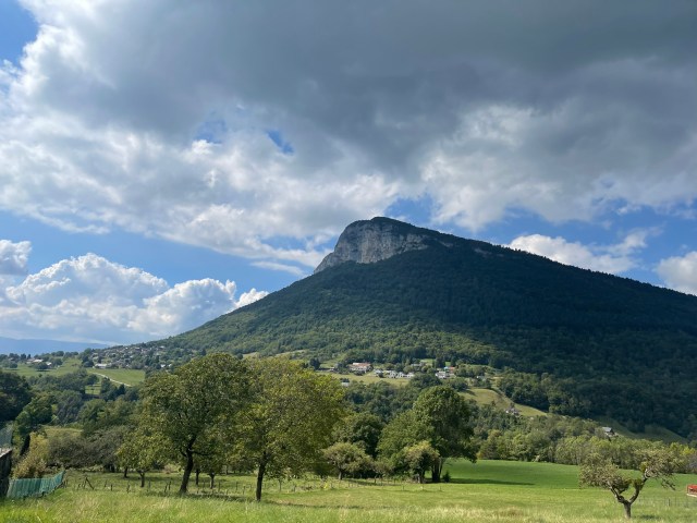
On Saturday morning, we went for a stroll in the market and then headed out for our day’s main activity, a “leisurely” 11.5km (7.2 mile) hike that we found on AllTrails called Circuit of the Bridges. It was in a small village called Saint-Jean-d’Arvey about 10km away. I neglected to notice that it was also 335m (1,000ft) higher than Chambéry. For those of you who do not know me, I am very skittish when it comes to heights. Driving up and down mountain roads is at best difficult and at worst has me wanting to curl up in the back seat and whimper – even when driving. So the ride up to the trailhead was a little unnerving, but we made it.
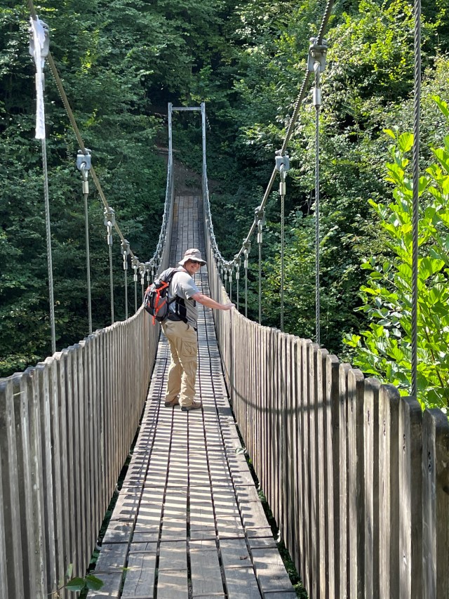
The trail started at 600m (2,000ft) and was easy to find, but AllTrails states that the elevation gain is 450m (1,500 feet) which is well within our limits; afterall, we climbed Toubkal in Morocco, which was 16km and 2,500m (8,000ft) in elevation gain – just to the base camp. However, that was 4 years ago, and we had not been sedentary for 18 months due to the pandemic. I found the hike quite difficult. It started by dropping 250m to a single span wooden bridge over a deep ravine. (Oh yeah! Walking across a wooden bridge with a terrible fear of heights! ) I took a deep breath and pressed on. (He’s very brave.) I even stopped for Sue (who has no fear of anything and is a hiking machine) to take a photo of me – I am attempting to smile.
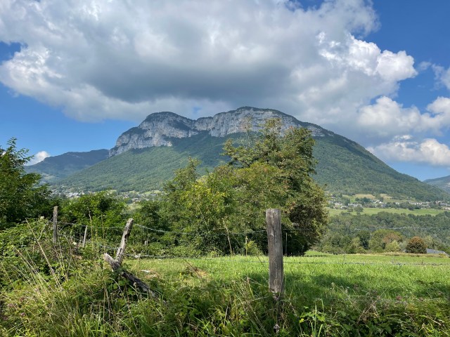
From that point it was an all-uphill hike to about 700 meters (2,300 ft). We had a picnic lunch along the trail and then climbed up and down the ravines. We made a detour of about 1.5km when we followed an incorrect sign on the path. (Oops! It said Thoiry, but we didn’t notice it also said “the long way.”) The village of Thoiry is about halfway through the hike. We had hiked almost 8km (5 miles) and I was done. Sue graciously agreed to cut short the hike and we took a couple of short cuts and ended back at our car in Saint-Jean-d’Arvey after about 12km (7.5 miles), a bit longer than the original hike length. I still don’t understand how we cut the hike in half and took a shortcut, but still hiked longer than the original long route. Faulty GPS, faulty AllTrails, faulty us? Over the entire walk we saw perhaps 10 people, so it was just us, our cameras and our thoughts. Enough words…Here are photos

The hike per AllTrails 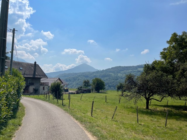
Are we having fun yet? 

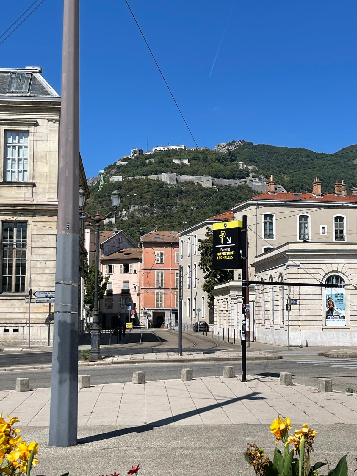
Sunday we decided to go to Grenoble to look around. We started by visiting the Resistance Museum. It was very well done (and free, but they did not have a “Viva la Resistance t-shirt — disappointing) and we spent about an hour in it. Afterwards we wandered into the old part of town and were terribly disappointed. Nothing was open (ach, dimanche!) and we just didn’t see anything of any interest. We walked back to the car and headed home.
Google says it is a 4-hour drive on the highway; we drove to Lyon on the highway, stopped for some lunch on the highway and made the grand decision that we were in no hurry to get home. Steven neglects to mention that we took the highway hoping that the rest stops were open since there was no other way to get food on Sunday. We told Google to find us a way home without the highways and off we went on a scenic tour of France. Boy do the French love roundabouts (des rond points). We hit one every kilometer or so. After a few hours we decided to head to a medieval city called Beaune that one of our friends said was pretty (also it is the wine capital of Burgundy). By the time we got there, it was about 7pm and we once again had a wander. (Restaurants were open. Viva la tourisme!) The place was packed with tourists and after about 45 minutes we had enough.
Once back in the car, we decided to go back on the highway and covered the last 130km in about 90 minutes. It was nearly 9pm by the time we got home. A long but very fun day.

Sue are you trying to kill my son??? He takes after me and you would NEVER get me on a bridge like that! ! ! By the way Steve I couldn’t see the smile, but did see the firm grip on the rope. Smart Boy!!! so glad you had a good weekend.
Hugs, Mom
LikeLike
Pingback: Dijon and Strasbourg and home (oh my) – Doing It On The Road